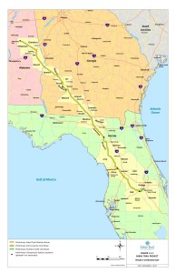
Current Maps
- All 527 alignment maps Sabal Trail filed with FERC in April 2016, in small, big, huge, and PDF formats, courtesy of Lowndes Area Knowledge Exchange (LAKE).
- Sabal Trail has also filed various smaller updates since then.
- A few of them have been published by WWALS Watershed Coalition, and the portions of the pipeline path nearest the Georgia-Florida border have been digitized; see Sabal Trail maps digitized.
Old Maps
All the maps below are OLD and in many places the route has changed.
- Sabal Trail’s 2 April 2014 alignment maps. The other two pipelines (Transco’s Hillabee Expansion Project and Florida Southeast Connection) did not submit maps on that date.
- The maps on Sabal Trail’s own website are those 2014 maps, which means they are old, out of date, no longer accurate.
-
 From Sabal Trail’s 15 November 2013 FERC filing:
-
Seen in earlier Sabal Trail meetings
or in the media.
-
See especially
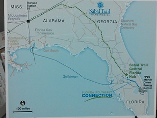
Sabal Trail Pipeline Context maps –Spectra Energy and FPL

-
See especially
Sabal Trail Pipeline Context maps –Spectra Energy and FPL
This project needs to take an alternate route.
Oppose, oppose, oppose!